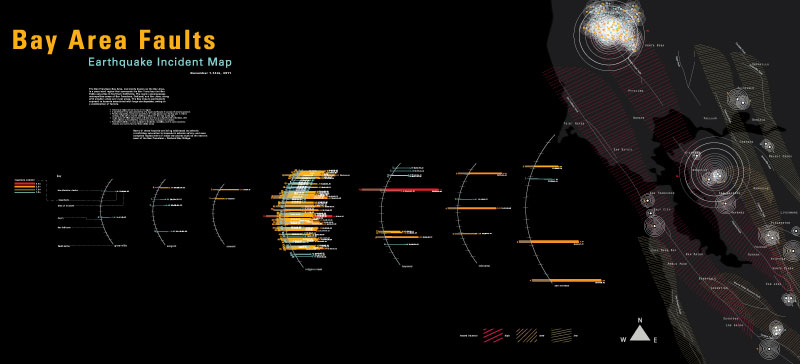
Earthquake Fault Infographic
Bay Area Earthquake Incident Map for mapping all the fault incidents for a portion of the month of November 2011. The information should be easily accessible in both macro/micro views. Each incident shows the magnitude, depth, location, fault line and time.
![](https://freight.cargo.site/t/original/i/77bb834b450a9de6a72acb2d39fa8d5e5bcd8f9499d956601e1831ee8d8443ad/quakeC3outline_o.jpg)
![](https://freight.cargo.site/t/original/i/5905b9781bc29957435095ae2484ad92decf6a6c84709fd9bf077549daa990a8/IMG_0522edit_o.jpg)
![](https://freight.cargo.site/t/original/i/650726ede1842cc76056b3fe5012f4aacf0646d044c207225d4c2628d10d89fd/IMG_0525edit_o.jpg)
![](https://freight.cargo.site/t/original/i/03e806c94237e8cf62799f5ad7465fe45229b36576bca5b0596d84bc12d1d632/IMG_0527edit_o.jpg)
![](https://freight.cargo.site/t/original/i/df0842bd7fae95a9eefeaf6c396ea5904ffdd9e964fde6a81baa56b1e725baf2/IMG_0530edits_o.jpg)